As tropics kick up, NHC says tropical depression could develop soon over Bahamas
Published in Weather News
ORLANDO, Fla. — A slow Atlantic storm season is finally growing active, with two hurricanes in the last week and a third system likely to develop with increased chances of impact on the U.S. coast.
Hurricane Humberto, the third hurricane of the season, formed late Thursday, though it currently poses no threat to land. But a new tropical wave now dubbed Invest 94L and likely to become Tropical Storm Imelda could roil the East Coast by the weekend or early next week, kicking up trouble in Florida, Georgia and the Carolinas.
The forecast is complicated by the possibility that Humberto and Imelda, positioned close to each other, will interact in unpredictable ways.
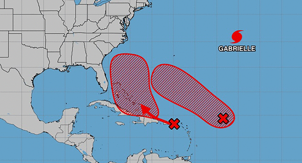
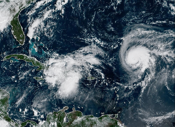
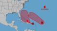
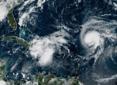
As of the 2 p.m. Eastern time tropical outlook, the National Hurricane Center said the tropical wave that had been moving from the Caribbean into the Atlantic had morphed into a low pressure system near eastern Cuba and the southeastern Bahamas.
“This system is producing a large area of disorganized showers and thunderstorms, and gusty winds. Gradual development of this system is expected, and it will likely become a tropical depression during the next day or so while it moves northwestward or northward across the central and northwestern Bahamas,” forecaster said.
Heavy rain and gusty winds continued to lash the Dominican Republic, Haiti, the Turks and Caicos Islands, the
southeastern Bahamas and eastern Cuba, likely to spread across the remainder of the Bahamas over the weekend.
“Tropical storm watches or warnings could be required for portions of the Bahamas and advisories on a potential tropical cyclone could be issued as early as later Friday,” forecasters said. “While there remains considerable
uncertainty in the long-range track and intensity of the system, there is a significant risk of wind, rainfall, and storm surge impacts for a portion of the southeast U.S. coast early next week.”
The NHC said there was a 90% chance the system will develop in the next two to seven days.
The National Weather Service in Melbourne said hazardous conditions are becoming more likely next week off the coast of Florida.
“Increasing seas along with long period swells are anticipated to cause rough, dangerous surf conditions along with a high risk of rip currents Sunday into Monday,” forecasters said noting both high surf advisories and rip current alerts would likely be needed. “Entering the surf will be strongly discouraged late this weekend into early next week.”
Marine conditions will also deteriorate with rough, choppy seas across the local Atlantic waters and intracoastal waters.
One of the uncertainties of what could become Imelda and Humberto is what forecasters called the Fujiwhara effect, when two adjacent tropical cyclones can begin to rotate around one another.
That makes predicting tracks more difficult.
“Current ensemble trends are split suggesting a slower storm could track more northeastward and away from the Florida coast, while a slightly faster track could have a more northward trend, paralleling offshore the Florida coastline,” forecasters said.
Hurricane Humberto forecast path as of 11 a.m. Friday, Sept. 26, 2025. (NHC) The busy tropics of late also saw the formation of the eighth named system on Wednesday when Tropical Storm Humberto developed in the Atlantic. It has since become the season’s third hurricane, and is forecast to grow in a major hurricane that could threaten Bermuda.
As of the NHC’s 11 a.m. advisory Friday, the center of the storm was located about 450 miles northeast of the Caribbean’s northern Leeward Islands moving northwest at 5 mph with maximum sustained winds of 90 mph, making it a Category 1 hurricane.
Hurricane-force winds extend out 10 miles while tropical-storm-force winds extend out 105 miles from its center.
“A west-northwestward to northwestward motion with a gradual increase in forward speed is expected during the next few days,” forecasters said. “Significant strengthening is expected over the next couple of days, and Humberto is forecast to become a major hurricane later today or on Saturday.”
For now, it is no threat to land, but the five-day forecast path includes Bermuda within the cone of uncertainty.
As for Hurricane Gabrielle, it transitioned into a post-tropical cyclone Thursday and blew past the Azores on Friday.
In the NHC’s final advisory Friday, the storm still had 65 mph sustained winds located about 245 miles east-northeast of Lajes Air Base in the Azores, headed east-northeast at 31 mph.
Tropical-storm force winds extend out 175 miles.
The climatological peak of the Atlantic hurricane season was on Sept. 10, but 60% of annual activity has historically happened after this date, the NHC stated.
The only other hurricane this season had been Hurricane Erin, which grew into a massive Category 5 system with 160 mph winds but remained in the Atlantic without making landfall.
The National Oceanic and Atmospheric Administration in early August updated its season forecast to call for 13-18 named storms this year, of which five to nine would grow into hurricanes. Two to five of those would develop into major hurricanes of Category 3 or higher.
Hurricane season runs from June 1 to Nov. 30.
-------------
©2025 Orlando Sentinel. Visit at orlandosentinel.com. Distributed by Tribune Content Agency, LLC.


Comments